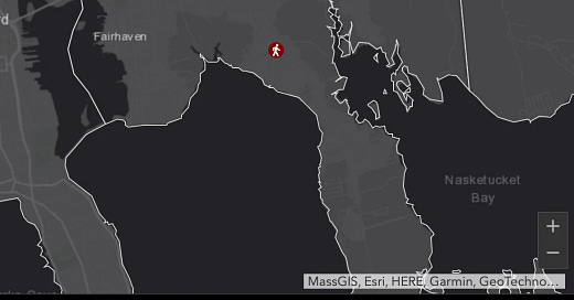
At age 29, Katie Brienzo was known around Fairhaven as an advocate for people with disabilities. She was a secretary for the Commission on Disabilities and had spoken supporting equality at the national convention of the Association of People Supporting Employment First. Katie was an important voice among the advocates who successfully lobbied to change the name of the MA Department of Mental Retardation to the Department of Developmental Services. As a person with a disability, Katie was attuned to the power names had to constrain or uplift individuals and groups.
Towns like ours are great places to live because of people like Katie— people whose light shines so bright you can’t help but feel its glow. Around her neighborhood on Sconticut Neck, people just refer to her as Katie, sometimes “our Katie”— she had a sense of belonging in a community that still holds her dear.
On November 8, 2012, Katie was walking to her sister’s house along Sconticut Neck with her friend Ellery and uncle Robert. The three went to cross the road at the crosswalk near the Emergency Management building, not far from Mac’s Soda Bar and less than half a mile from the Wood School. According to her mother Karen Fostin, Katie was a real rule-follower when it came to crossing at crosswalks. When Katie was younger, Karen had never really worried about her daughter darting into traffic. But on that day, before Katie could reach the other side of the road, an inattentive driver hit Katie and Robert, killing Katie instantly and injuring her uncle.
Karen, who grew up on Sconticut Neck and still lives there today, carries the grief of a parent who has lost her child. She refuses to let people forget Katie’s light. She continues to advocate for the passage of Katie’s Law, which would impose stiffer penalties on drivers who leave the scene of an accident resulting in death.1
Only a decade has passed since Katie’s death. The wound is still fresh for Karen Fostin and her family. That’s why it was so painful for them when this past February, Carolyn Preece, an elderly neighbor of hers, was killed on Sconticut Neck not far from where Katie was killed in 2011. While the details have not yet been made public, the DA’s office stated that Preece had been wearing dark clothing and had not been crossing in a crosswalk and that the driver had not been under the influence or otherwise distracted. They further stated that the killing was a “tragic accident.”
It saddens me to think we live in a place where, in order to walk on their neighborhood streets as they always have, the burden is on our elders to light themselves up like a Christmas tree to avoid being randomly killed. Where periodically losing someone irreplaceable like Katie Brienzo is seen as a regrettable but unavoidable tragedy. Where Safe Routes to Schools is seen as an aspirational slogan for a grant program and not a fundamental right for our kids.
How did we get here?
Here’s my take, specific to Sconticut Neck but applicable in other areas of town:
Thin Growth + Highway Design Applied to Town Streets
Sconticut Neck grew over time, but mostly post-WWII, so in a way that I’d call “thin”— dominated by large single-family lots and without businesses within walking or biking distance. This naturally increased car traffic (more people, running all their errands by car). As traffic increased over time on Sconticut Neck Road, engineers adapted its overall design to accommodate higher car speeds, both to prevent congestion and make the trip easier for commuters. Travel lanes were widened. Roadside trees (and parts of homeowners’ yards) were removed to enhance the “clear zone.” Karen Fostin remembers when MassDOT used eminent domain to widen the road, shrinking her front lawn in the process. In more recent history, a turning lane was added in front of Wood School to prevent congestion at pickup and dropoff. In addition, in 1974 MassDOT built Highway 240, a 1.3-mile stretch of controlled-access road that lays claim to the dubious title of being Massachusetts’ shortest highway. This highway flows directly into Sconticut Neck Road.
All of these changes prioritized the speed and flow of car traffic. Collectively, they act as subconscious cues to us as drivers, lulling us into what psychologist Daniel Kahneman calls System 1 thinking— our mind goes on autopilot and we’re free to think about other things, fiddle with the radio or talk to a passenger. In sum, the design of this road induces higher speeds, coupled with passive attention on the part of drivers. There would be nothing wrong with that if the road’s only purpose were to get cars quickly and safely to and from the end of the Neck. The problem is that there are still parts of Sconticut Neck that operate as a neighborhood street, where businesses, pedestrians, and cars share space. This combination— a road designed for 30+ MPH (regardless of the posted speed) combined with pedestrian and business activity— has made these parts of Sconticut Neck Road dangerous for both drivers and pedestrians.
I know that this is a big over-simplification! I want to pause before I continue to prompt those of you reading with deeper expertise and/or more local knowledge to let me know what you think of this claim about Sconticut Neck Road. What am I missing? Do you disagree? Why?
Introducing the Stroad
Chuck Marohn has a name for dangerous road/street combos like Sconticut Neck’s northern section: stroads. It’s a lovely name for a lovely piece of design. According to Marohn:
A stroad is a street/road hybrid. It is the futon of the transportation system. A futon is an uncomfortable couch that converts into an uncomfortable bed, something that performs two functions but does neither well. A stroad tries to be both street and road, providing both mobility and access, yet fails miserably at both.
Here’s Not Just Bikes on stroads:
While not yet the most developed stroad (Route 6 I’m looking at you!), the northern section of Sconticut Neck Road, with its businesses, school, and pedestrian activity, brings all the dangers of its northern sibling.
According to MassDOT’s published data, our stroads, particularly Route 6, and Sconticut Neck Road, in addition to Main Street, (a budding stroad in places) are responsible for six out of seven road fatalities (pedestrian and driver) in Fairhaven in the past eight years.
You could argue that it makes sense that all of Fairhaven’s road deaths occur on these roads, as they are the most highly traveled roads in town. Doesn’t the higher volume necessarily mean that there will be some accidents? If that were true, however, we’d expect to see a higher number of deaths on the interstate running through Fairhaven (there were zero in the past eight years).
Chuck Marohn, himself a former engineer who used to design stroads, makes a strong case that they are unacceptably dangerous. Fairhaven’s fatalities data align with this case. Unsafe road design carried out in the past by MassDOT, coupled with the failure of the state to rectify this design, is in large part responsible for these deaths.
A Tour of The Haven’s Stroads
Here’s the section of Sconticut Neck where Katie Brienzo was killed (pictured a year after her death):
The road is mostly a straightaway, with some long, forgiving curves. Wide lanes of travel. Large curb cuts allow for easier and faster driving in and out of the many access points, which are for both businesses and homes. A skinny sidewalk on one side connected by a crosswalk to ??.
Here’s a recent image of where Carolyn Preece was killed (.2 miles from Katie):
The popular Mac’s Soda Bar is behind and to the left. The large signs on the right are designed to be seen from a distance by drivers who are going faster than the posted speed limit (25mph). As with the other stretch of road pictured, look at the curb cuts on the right (East side) of the road. Would you feel safe here as a pedestrian?
Here’s the Stroad 6 site of two additional deaths (one motorcycle, one pedestrian) in recent years.
Route 6 here is a classic four-lane stroad, widened at the intersection by additional turning lanes. There’s a bus stop on the right, just past the 7-Eleven— a lovely place to wait for your ride. Any of you who have been outside of a car in this area know what it feels like to try to navigate it. Likewise, all of us who live here know how frustrating and harrowing it can be to drive here!
While there are particularities to each case, all of our fatalities in recent history have occurred in places where stroad design brings together roads that induce drivers to drive at deadly speeds with lots of access points (driveways and intersecting streets) and town life (pedestrians, bikes, and businesses). The result of that combination played out over thousands of iterations, has been the loss of at least six lives.
Our Complacency
Over the past decade, our town averages just below one death a year (.7) on our roads (this includes driver as well as pedestrian and bike fatalities). To use a standard metric, we’re at about 5.4 deaths per 100,000 people. This is above the state average (4.9). If you look at the data by town, you can see that there are 62 towns in MA that have had zero deaths in the past decade. We should aspire to be one of those towns!
A good place to start would be to take a close look at our stroads, where these deaths keep happening. If a serial killer had, over eight years, killed six people in our town (and attempted to kill many others), we would undoubtedly be enthusiastic and united in our demand that the authorities apprehend this individual. In the case of our stroads, which have claimed as many lives, we’ve been lulled into complacency by narratives that place blame on victims (not wearing bright colors!) or drivers (distracted or irresponsible) and negate the impact of poorly designed roads. It’s as if, each time the serial killer claimed a victim, we collectively shrugged and muttered something about the victim forgetting to travel in an armed group. For now, installing blinking signs, stepping up random speed enforcement, and dressing ourselves up in bright colors are at best a distraction and most certainly a waste of our time. We need to be smart and go after the poor design issues plaguing our stroads. It’s time we went after the killer!
More to Come: Stroad Mitigation and Why It Makes Economic Sense
How we go about fixing our stroads deserves its own post(s). At its most basic, stroad mitigation is about determining whether the stroad in question needs to become a road, designed for throughput and speed, or a street, designed for economic productivity and town life. In the former case, you need to reduce complexity, in the latter case, you invite it. In the case of all of our stroads, my guess is that there are stretches of them that ought to become streets, with parts on either side of those stretches set aside for use as roads.
Another reasonable question that may have come to mind is whether there are some benefits to having these stroads that we stand to lose if we suddenly turn them into efficient roads or safe and productive streets. My short answer is no— stroads are a major reason why a town that should be prosperous is currently having a tough time balancing its budget. More analysis on that is to come. That will be a discussion that brings us back to the idea of thickening our current residential areas and to another promised topic, our downtowns!
I’m Serious— Push Back!
As always, thanks for staying with me here. Likewise, as this writing is primarily for me to work out my own learning, please keep pushing back. I want to see the disconfirming evidence! I am new to these topics and many of you have helped me understand more of the local history and provided me with additional data and perspective.
Lastly— a warm thank you to Karen Fostin, who spent time speaking with me about her amazing Katie and who continues to be a positive voice in our community.
The driver who killed Katie left the scene. She also had multiple driving-related offenses on her record prior to this incident.
My first introduction to Strong Towns was through a video about the infamous Stroad, the pinnacle of our consumer culture evolution. It has everything that a resident of Cartown, USA, could ever hope for: massive, perennially empty parking lots, a gas station every mile or two, drive-throughs to avoid pedestrian traffic, and wide lanes designed for maximum speeds. Unfortunately, our Stroad 6 also has the most morbid feature common to this type of car infrastructure: the blood of our friends and neighbors mixed indelibly into the asphalt. Clearly, we need a solution to ensure everyone's safety.
When I learned about the 40R proposal currently in development, I saw a perfect solution to the asphalt blight that is our Stroad 6. With the proposed overlay, we can have a Charleston Block that uses intentionally designed infrastructure to promote community values that are essential for the safety and well-being of our citizens. This would include bike paths, on-street parking, traffic calming measures, and a space designed primarily for people, not cars. We can create a neighborhood that supports a variety of local businesses and solves our financial problems by adding the proposed 500+ units, potentially increasing our tax revenue by millions of dollars per year while creating jobs and housing.
Ideally, instead of having just five or so 40R developers, we could have 280 individual stakeholders build ADUs in their backyard after a few years of fighting to have the regulations tweaked. This type of organic growth has its appeal and benefits. However, we could also have a fully "thickened" neighborhood designed to serve as an example of the benefits of thickening on communities and local businesses with a robust customer base by supporting the 40R effort and shaping the proposal to meet the needs of our community perfectly.
This golden opportunity to fix our Stroad 6 will not come around again any time soon. While focusing solely on the plaza portion of the Stroad 6 would not have been enough to prevent the most recent tragedy, it could help prevent future ones while simultaneously providing a host of quality-of-life benefits to existing residents and future citizens. Let's not squander this opportunity to have a positive impact on potentially thousands of current and future citizens of Fairhaven.